

Back when we planned this trip, the main goals had been to go somewhere neither of us had ever been, test my ability to fly and travel, and to see whales. Because one of the things Juneau is known for is the Mendenhall Glacier, we had also talked about taking one of the tours out to see it and it’s visitor center. Then Scott stumbled across a company called Adventure Bound Alaska and their daylong trip through the fjords to see glaciers, waterfalls, and icebergs. It sounded amazing and like one of those things you kinda need to do once in a lifetime, so we signed up.

We were booked on the 56′ foot boot The Adventure Bound with Captain Steve. The trip was only about 3/4 full with 32 passengers so we had a little room to stretch out. They’d told us we could get sandwiches and the like on board or bring our own. Having hit up the local organic grocery, we brought our own which worked out very well.

The outbound trip was about 45 miles south from Juneau through the Gastineau Channel to Stephens Passage, along Admiralty Island.

Along the way we came across a Humpback Cow and Calf feeding near the shore and got to watch them for a little bit (I didn’t manage any photos of them) before heading on to Holkham Bay, which opens on to Tracy Arm on one side and Endicott Arm on the other.

At the mouth of Holkham Bay Captain Steve did a quick visual survey of the entrance to Tracy Arm and determined that there was too much ice clogging the passage to safely pass through to Sawyer glacier and that he would take us up Endicott Arm to see Dawes glacier instead.
On the way to Dawes we got to icebergs! How have I lived my life without actually seeing icebergs in person? They are so freaking cool, yes, literally, but in all the other ways as well.


One of the firsts ones we saw rose maybe three feet up from the waters surface, and at least six feet wide just under the water line. Given that the rule of thumb is that when you see an iceberg on the surface of the water, you’re only seeing the top 10% of its mass, they had to be 30+ feet deep below the surface. And the color! It was that almost unreal shade glowing white/blue that means the ice is so densely packed there aren’t a lot of air bubbles within. I’d seen pictures, but seeing it in person is sort of mind boggling. And they were peaceful. Not doing anything, just hanging out, bumping along the fjord. Just ice. All compacted in one, potentially dangerous for boats, but useful for mammals, form. And gorgeous. I’m pretty sure I was grinning from the first iceberg and didn’t stop until sometime on the way back to Juneau.

A little further on brought us to the base of Dawes glacier.

Watching Dawes come closer, revealing and distilling itself out of the mix of light and shadow, rock walls and milk glass green water, was mesmerizing. It was hard to comprehend what I was seeing. It was a little surreal. I have seen photos of glaciers and they looked exactly like the one I was staring at, but this one was real. It was freezing cold, because duh, glacier and hard packed ice, and not empty exactly, but so differently embodied that it felt barren in a way that places with an abundance of green don’t. There was a whole lot of “holy shit wow” running in my head as we approached, kind of this hum of amazement at being there, seeing this raw and enormous part of our world and an oddly mellow part of my head that needed to be reminded that I was actually there, not watching it all on a screen somewhere cold.

One of the things I hadn’t understood about fjords is that to qualify as a fjord the waterway must terminate in a glacier. If they don’t, they are just boring waterways. It took me a bit to process the fact that to be the termination point, Dawes had to be not just a mass of ice surfing on the water, but in fact go all the way down through the water to the rock bottom of the carved out passage that made up the fjord. What we were seeing was the end portion of the glacier that was damming up Endicott Arm with ice and rock.


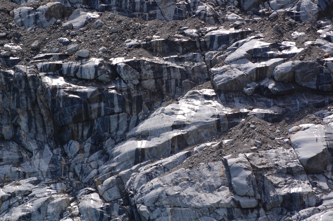
In front of us was ice and water and around us was rock and much of that rock showed the signs of the glacier’s passage as it grew and receded over time. It looks almost as if someone or something had dragged claws along the walls, gouging out tracks and lines as they went. Being there, seeing rock and ice formations that seemed almost unreal, I could understand why my ancestors once believed the Jötnar, the Ice Giants, were real, and why we called on the gods to tame them, to protect us from their nearly unfathomable power. With out the gas powered metal beast I had come in, I would have been much more afraid of what I was seeing and hearing. Run into that at night or in a storm, and he’ll yes I’d be terrified and calling on all the gods for help.
EndicottArmVideo Traveling up Endicott Arm toward Dawes Glacier, video by K. Pennington

IMG_2043 Dawes Glacier Video by S. Pennington
Far above where we were, near to and within the Juneau ice fields where Dawes and most of the other local glaciers originate, the weight of new ice presses down and forces the glaciers towards the warmer zones. It’s down here that the Dawes and its relatives shed bits of themselves through Calving . And while, yes, Dawes, like most of the worlds glaciers is receding because of the assortment of environmental changes we humans have wrought, calving is also part of the natural life cycle of a glacier to expand, recede, expand, and recede over the eons.


Calving is a pretty amazing thing to see and hear. Scott got video of one of the larger events we saw while I snapped away with my deli and telephoto lens. Between the two of us we got some very cool images.
CalvingGlacier video by S. Pennington
Watching for calvings is a big waiting game. You listen for this sound that’s sort of like a growl and sort of like a crack or shot and hunt the face of the glacier for pieces shifting. Sometimes that sound didn’t tie to anything we could see from our vantage point. I’m fairly certain that we heard some calving that was actually happening inside of gullies or breaks in the facade that we couldn’t see into. Enough of the calving happened on the putter surface that we got to watch many blocks break off and drop into the water forming icebergs. After one of the bigger events we e able to watch the wave formed by the mass of ice falling, move out and away from the glacier towards us. It wasn’t enough to do more than rock our boat a little, but in watching that I could begin to understand what havoc large pieces of land falling into the sea could cause. We also saw the fallen blocks vanish into the water and after a moment or two, rise up as newly born icebergs that bobbed and sorted themselves out.

There were so many different shapes and forms within the face of the glacier, it was hard not to take pictures, not to come back time and again to the glow of blue slanted blocked along one ridge the arch that looked carved by tools, the doorway that promised a trip somewhere else, fingers and columns and a giant blue spot like the glaciers on spot of Jupiter.


I also found myself fascinated by the edges where rock and ice met. On one side of the canyon the rock was light tan, on the other it was dark charcoal gray, each overlapped / challenged and touched by vertical creeping seams of white and pale gray.


Eventually we made our way back down Endicott Arm and then turned into Fords Terror, which is a branch of waterway that is guarded by a section of rock and shore that is treacherous to pass through at low tide, but seems easy at high tide with a good captain. Past the entrance were treated to an array of incredibly beautiful waterfalls, one that ran from the top of the cliff face, down to a break in one, really smooth, thought rowdy cascade and then rumbling over rocks in a wide swath down the rest of the way to the water. Another between two steep juts of cliff, a blink and you miss it opening that opened to this spectacular tumble of rocks sloping out and down from a point at the back where water fell across the rocks like an enormous reclining water nymph. The fact that captain steve brought the boat nearly to the edge of the waterfall and then backed out of the narrow space was its own form of amazing.


At one point several of the passengers spotted a brown bear on shore, I missed it, but it was still an exciting moment for everyone. We also saw a bunch more waterfalls, including this amazing and massive sort of double fall.


As we worked our way back toward Juneau, along Stephens Passage, Captain Steve took us past a collection of narrow islands populated with bald eagles and sea lions.


Back in the Gastineau Channel we passed a humpback cow who’s tail had become ensnared in the lines for a crab pot, and her calf. There was a coast guard ship following them, waiting for word from noaa as to what everyone wanted to do about getting her free.

The ride home was long but well worth it for everything we’d seen. After ten hours on the water, Scott and I were both very happy to be back on land and very very happy with our adventurers.
